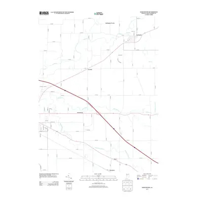
2013 Map of Darlington
USGS Topo · Published 2013About this map
Darlington serves as the primary hub on this Montgomery County map, where the winding course of Sugar Cr meets Honey Cr. The landscape is defined by its complex drainage network, including the Walnut Fork Sugar Cr and the meticulously charted Needham Booher Ditch, which reflect the area's agricultural development. Small rural communities like Mace, Smartsburg, and Linnsburg are connected by a grid of county roads that carve through the timber of Darlington Woods. This 2013 survey illustrates the modern configuration of local infrastructure, from residential streets like Pike St and Madison St in the town center to the expansive network of rural routes such as Co RD-500 and Co RD-100 that serve the outlying farmsteads and creek valleys.
Find a feature on this map
73 named features on this map. Tap any name to fly to it.
Don’t see what you’re looking for? This feature index may not catch every label — zoom into the map to look around manually.
Map Details
Editions of this 2013 Darlington Map
This is the sole edition of this map. No revisions or reprints were ever made.
Other maps of this area

1953 · Danville
USGS Topo · 1:250,000

1953 · Indianapolis
USGS Topo · 1:250,000

1955 · Danville
USGS Topo · 1:250,000

1956 · Danville
USGS Topo · 1:250,000

1956 · Indianapolis
USGS Topo · 1:250,000

1956 · Crawfordsville
USGS Topo · 1:24,000

1956 · New Market
USGS Topo · 1:24,000

1957 · Indianapolis
USGS Topo · 1:250,000

1957 · New Ross
USGS Topo · 1:24,000

1958 · Darlington
USGS Topo · 1:24,000