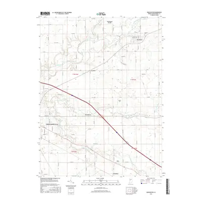
2016 Map of Darlington
USGS Topo · Published 2016About this map
Darlington serves as a prominent focal point in this portion of Montgomery County, situated where Sugar Creek and Honey Cr converge. The landscape is defined by the winding paths of these waterways, including Little Sugar Creek and Walnut Fork Sugar Creek to the south. Small, established settlements such as Garfield, Smartsburg, and Mace are connected by a rigorous grid of county roads, reflecting the agricultural heritage of the region.
Find a feature on this map
122 named features on this map. Tap any name to fly to it.
Don’t see what you’re looking for? This feature index may not catch every label — zoom into the map to look around manually.
Map Details
Editions of this 2016 Darlington Map
This is the sole edition of this map. No revisions or reprints were ever made.
Other maps of this area

1953 · Danville
USGS Topo · 1:250,000

1953 · Indianapolis
USGS Topo · 1:250,000

1955 · Danville
USGS Topo · 1:250,000

1956 · Danville
USGS Topo · 1:250,000

1956 · Indianapolis
USGS Topo · 1:250,000

1956 · Crawfordsville
USGS Topo · 1:24,000

1956 · New Market
USGS Topo · 1:24,000

1957 · Indianapolis
USGS Topo · 1:250,000

1957 · New Ross
USGS Topo · 1:24,000

1958 · Darlington
USGS Topo · 1:24,000