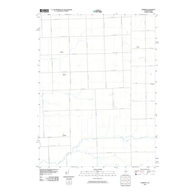
2010 Map of Darrow
USGS Topo · Published 2010About this map
Sugar Creek and its tributary Mud Creek meander through this agricultural landscape on the Illinois-Indiana border, defining the drainage patterns of the southern Iroquois County area. The small settlements of Darrow and Cutmer serve as the primary local hubs, connected by a precise grid of rural roads like E 1100 North Rd and N 2700 East Rd. This 2010 survey illustrates the persistence of small-scale infrastructure, including the private Disosway Airport and several historic burial sites such as Fleming Cemetery and Blue Ridge Cemetery. The terrain is characterized by a managed water system, where natural flows are supplemented by engineered waterways like Possum Trot Ditch and Sheldon Ditch Number 1, reflecting the region's long-standing reliance on effective field drainage for successful cultivation.
Find a feature on this map
40 named features on this map. Tap any name to fly to it.
Don’t see what you’re looking for? This feature index may not catch every label — zoom into the map to look around manually.
Map Details
Editions of this 2010 Darrow Map
This is the sole edition of this map. No revisions or reprints were ever made.
Other maps of this area

1935 · Watseka
USGS Topo · 1:48,000

1938 · Milford
USGS Topo · 1:48,000

1939 · Watseka
USGS Topo · 1:62,500

1944 · Milford
USGS Topo · 1:62,500

1953 · Danville
USGS Topo · 1:250,000

1955 · Danville
USGS Topo · 1:250,000

1956 · Danville
USGS Topo · 1:250,000

1961 · Kentland
USGS Topo · 1:24,000

1962 · Boswell
USGS Topo · 1:24,000

1962 · Earl Park
USGS Topo · 1:24,000