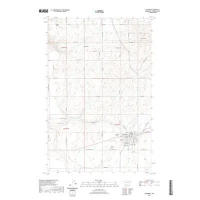
2020 Map of Davenport
USGS Topo · Published 2020About this map
The Davenport townsite serves as a central hub on this 2020 topographic map of Lincoln County, anchored by the Lincoln County Courthouse and the local Davenport Airport. The landscape is defined by its drainage patterns, with several prominent watercourses including Cottonwood Cr, Hawk Cr, and Bluestem Cr carving through the plateau. Local landmarks like Teel Hill and Stock Canyon emphasize the relief of this agricultural region.
Find a feature on this map
106 named features on this map. Tap any name to fly to it.
Don’t see what you’re looking for? This feature index may not catch every label — zoom into the map to look around manually.
Map Details
Editions of this 2020 Davenport Map
This is the sole edition of this map. No revisions or reprints were ever made.
Other maps of this area

1948 · Lincoln
USGS Topo · 1:62,500

1948 · Turtle Lake
USGS Topo · 1:62,500

1950 · Lincoln
USGS Topo · 1:62,500

1950 · Turtle Lake
USGS Topo · 1:62,500

1953 · Ritzville
USGS Topo · 1:250,000

1959 · Ritzville
USGS Topo · 1:250,000

1965 · Ritzville
USGS Topo · 1:250,000

1969 · Bluestem
USGS Topo · 1:24,000
1969 · Mondovi
USGS Topo · 1:24,000

1969 · Rocklyn
USGS Topo · 1:24,000