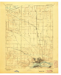
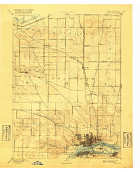
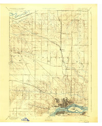
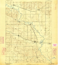
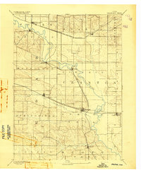
1894 Map of Davenport
USGS Topo · Published 1906About this map
The Mississippi River defines the southern reach of this Scott County landscape, where the bustling streets of Davenport sit across from Rock Island. Surveyed in the late 1880s, the map reveals a well-developed grid of rural townships including Sheridan and Hickory Grove, connected by a dense web of iron rails. The Chicago Milwaukee and St. Paul Railroad cuts a diagonal path through the prairie, linking small agricultural hubs like Eldridge and Donahue to the river port.
Find a feature on this map
33 named features on this map. Tap any name to fly to it.
Don’t see what you’re looking for? This feature index may not catch every label — zoom into the map to look around manually.
Map Details
Editions of this 1894 Davenport Map
4 editions found

Other maps of this area

1890 · Durant
USGS Topo · 1:62,500

1891 · DeWitt
USGS Topo · 1:62,500

1891 · Davenport
USGS Topo · 1:62,500
1892 · Wheatland
USGS Topo · 1:62,500

1892 · Goose Lake
USGS Topo · 1:62,500

1892 · Leclaire
USGS Topo · 1:62,500

1893 · Leclaire
USGS Topo · 1:62,500
1894 · Wheatland
USGS Topo · 1:62,500

1894 · Durant
USGS Topo · 1:62,500
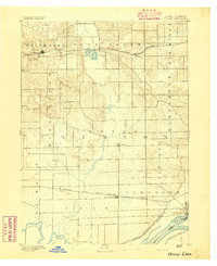
1894 · Goose Lake
USGS Topo · 1:62,500
Featured Places
- Davenport, IA
- Moline, IL
- Bettendorf, Pleasant Valley Township
- Rock Island, IL
- Eldridge, Sheridan Township