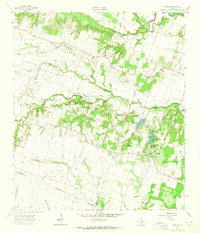
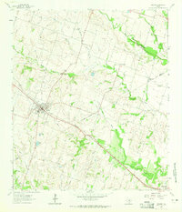
1963 Map of Davilla
USGS Topo · Published 1965About this map
Davilla serves as the primary hub in this rural landscape at the crossroads of Bell, Milam, and Williamson counties. The settlement pattern is defined by several dispersed rural communities and family-named landmarks like Science Hill and the small hamlet of Vilas. For genealogists, the map is remarkably dense with burial grounds, including Jackson Cem, Simmons Cem, Hennington Cem, and Server Cem, offering a detailed view of family settlements along the local watercourses.
Find a feature on this map
29 named features on this map. Tap any name to fly to it.
Don’t see what you’re looking for? This feature index may not catch every label — zoom into the map to look around manually.
Map Details
Editions of this 1963 Davilla Map
2 editions found
Other maps of this area

1885 · Taylor
USGS Topo · 1:125,000

1887 · Taylor
USGS Topo · 1:125,000

1894 · Taylor
USGS Topo · 1:125,000

1910 · Buckholts
USGS Topo · 1:24,000

1912 · Buckholts
USGS Topo · 1:31,680

1954 · Austin
USGS Topo · 1:250,000
1963 · Sharp
USGS Topo · 1:24,000

1963 · Friendship
USGS Topo · 1:24,000
1963 · San Gabriel
USGS Topo · 1:24,000
1964 · Rogers
USGS Topo · 1:24,000