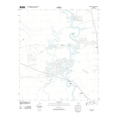
2010 Map of Davis Hill
USGS Topo · Published 2010About this map
The Trinity River dominates this landscape as it meanders through Liberty County, carving out complex oxbows and sloughs. Named settlements and landmarks trace the history of the riverfront, from the established site of Coushatta Village and the remote Jacob Settlement to the community of Franklin. The terrain is defined by elevated features like Davis Hill and Tanners Bluff, which overlook a network of water bodies including Sevenmile Bend, Horseshoe Lake, and Hanners Bend Lake.
Find a feature on this map
62 named features on this map. Tap any name to fly to it.
Don’t see what you’re looking for? This feature index may not catch every label — zoom into the map to look around manually.
Map Details
Editions of this 2010 Davis Hill Map
This is the sole edition of this map. No revisions or reprints were ever made.
Other maps of this area

1943 · Liberty
USGS Topo · 1:125,000

1954 · Beaumont
USGS Topo · 1:250,000

1955 · Daisetta
USGS Topo · 1:62,500

1955 · Saratoga
USGS Topo · 1:62,500

1955 · Rayburn
USGS Topo · 1:62,500

1955 · Liberty
USGS Topo · 1:62,500

1957 · Beaumont
USGS Topo · 1:250,000

1984 · Beaumont
USGS Topo · 1:250,000
1984 · Rayburn
USGS Topo · 1:24,000
1984 · Arizona Creek
USGS Topo · 1:24,000