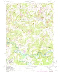
1968 Map of Dayton
USGS Topo · Published 1982About this map
Industrial resource extraction and rural crossroads define this portrait of the Pennsylvania interior, where the borders of Armstrong, Jefferson, and Indiana Counties converge. The landscape is heavily marked by the coal and gas industries, with numerous Gas Wells and pervasive Strip Mines following the contours of the hills. Transportation is anchored by the Pittsburgh and Shawmut RR and the Baltimore and Ohio RR, which serviced the region's productive output.
Find a feature on this map
51 named features on this map. Tap any name to fly to it.
Don’t see what you’re looking for? This feature index may not catch every label — zoom into the map to look around manually.
Map Details
Editions of this 1968 Dayton Map
4 editions found
Other maps of this area

1901 · Rural Valley
USGS Topo · 1:62,500

1903 · Rural Valley
USGS Topo · 1:62,500

1906 · Clarion
USGS Topo · 1:62,500

1907 · Clarion
USGS Topo · 1:62,500

1909 · Smicksburg
USGS Topo · 1:62,500

1924 · Brookville
USGS Topo · 1:62,500

1926 · Brookville
USGS Topo · 1:62,500

1938 · Smicksburg
USGS Topo · 1:62,500

1939 · Smicksburg
USGS Topo · 1:62,500

1944 · Brookville
USGS Topo · 1:62,500