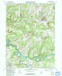
1968 Map of Dayton
USGS Topo · Published 1993About this map
Mahoning Creek Lake dominates the southern landscape of this terrain, where the waters of the Little Mahoning Creek and Mahoning Creek meet. The area is defined by the intersection of Armstrong, Jefferson, and Indiana counties, a region historically shaped by both surface mining and natural gas extraction. Small settlements like Timblin, Ringgold, and Dayton serve as local hubs, connected by a network of rural roads and the occasional distinctive landmark like the Travis Landing Strip.
Find a feature on this map
45 named features on this map. Tap any name to fly to it.
Don’t see what you’re looking for? This feature index may not catch every label — zoom into the map to look around manually.
Map Details
Editions of this 1968 Dayton Map
4 editions found
Other maps of this area

1901 · Rural Valley
USGS Topo · 1:62,500

1903 · Rural Valley
USGS Topo · 1:62,500

1906 · Clarion
USGS Topo · 1:62,500

1907 · Clarion
USGS Topo · 1:62,500

1909 · Smicksburg
USGS Topo · 1:62,500

1924 · Brookville
USGS Topo · 1:62,500

1926 · Brookville
USGS Topo · 1:62,500

1938 · Smicksburg
USGS Topo · 1:62,500

1939 · Smicksburg
USGS Topo · 1:62,500

1944 · Brookville
USGS Topo · 1:62,500