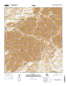
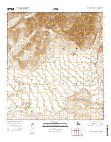
2015 Map of De Long Mountains A-3 NW
USGS Topo · Published 2015About this map
The high-latitude terrain of the De Long Mountains dominates this portion of the Arctic, where the drainage systems and ridgelines serve as the natural foundation for modern administrative boundaries. This map documents the remote intersection where the North Slope Borough meets the Northwest Arctic Borough, a line that follows the height of land across this uninhabited stretch of the Brooks Range. The topographic detail highlights prominent elevation features such as the Wulik Peaks and the carved descent of Kunruk Canyon. As a 2015 study by the U.S. Geological Survey, the map provides an essential record of the physical geography of the western Arctic, capturing the land exactly as it remained before any further industrial or infrastructure development in these northern latitudes.
Find a feature on this map
8 named features on this map. Tap any name to fly to it.
Don’t see what you’re looking for? This feature index may not catch every label — zoom into the map to look around manually.
Map Details
Editions of this 2015 De Long Mountains A-3 NW Map
This is the sole edition of this map. No revisions or reprints were ever made.
Other maps of this area

1951 · De Long Mountains
USGS Topo · 1:250,000

1955 · De Long Mountains
USGS Topo · 1:250,000

1955 · De Long Mountains A-3
USGS Topo · 1:63,360

1955 · De Long Mountains A-4
USGS Topo · 1:63,360

1955 · De Long Mountains B-3
USGS Topo · 1:63,360
1955 · De Long Mountains B-4
USGS Topo · 1:63,360

1965 · De Long Mountains
USGS Topo · 1:250,000
2015 · De Long Mountains A-3 SE
USGS Topo · 1:25,000
2015 · De Long Mountains B-4 SE
USGS Topo · 1:25,000
2015 · De Long Mountains A-3 SW
USGS Topo · 1:25,000