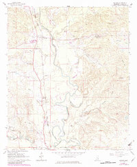
1964 Map of De Soto
USGS Topo · Published 1982About this map
The Chickasawhay River meanders through this Clarke County landscape, defining the local geography with its complex oxbows and cutoffs like the McCormick Cutoff and Johnson Cutoff. During the mid-1960s, the community of De Soto served as a key point along the Illinois Central Gulf railroad, which parallels the river valley. The map reveals a deeply rooted rural society through its numerous congregations and burial grounds, including Old Spring Hill Ch, Spring Hill Ch, and St Johns Ch. To the south, the Shubuta Corp Bdy marks the edge of town near Bogue Homo Creek. The varied terrain also features the open expanse of Sels Prairie and landmarks like the Flowing Well, illustrating the intersection of natural water sources and human settlement in eastern Mississippi.
Find a feature on this map
37 named features on this map. Tap any name to fly to it.
Don’t see what you’re looking for? This feature index may not catch every label — zoom into the map to look around manually.
Map Details
Editions of this 1964 De Soto Map
2 editions found
Other maps of this area

1953 · Hattiesburg
USGS Topo · 1:250,000

1953 · Meridian
USGS Topo · 1:250,000

1957 · Meridian
USGS Topo · 1:250,000

1957 · Quitman
USGS Topo · 1:62,500

1957 · Enterprise
USGS Topo · 1:62,500

1958 · Hattiesburg
USGS Topo · 1:250,000

1964 · Carmichael
USGS Topo · 1:24,000

1964 · Eucutta
USGS Topo · 1:24,000

1964 · Hale
USGS Topo · 1:24,000

1964 · De Soto
USGS Topo · 1:24,000