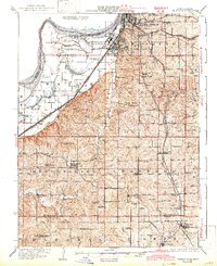
1927 Map of Dearborn
USGS Topo · Published 1942About this map
Saint Joseph and its southern industrial core dominate the northern reaches of this Missouri riverfront landscape. The extensive Stockyards in South Saint Joseph reflect the regional importance of the livestock trade during the early twentieth century, supported by a dense network of railroads including the Chicago Burlington and Quincy and the Chicago Rock Island and Pacific. The Missouri River's shifting path is evident in the complex oxbows and sloughs like Contrary Lake, Old Mud Lake, and Beck Slough, which define the western boundary with Kansas.
Find a feature on this map
75 named features on this map. Tap any name to fly to it.
Don’t see what you’re looking for? This feature index may not catch every label — zoom into the map to look around manually.
Map Details
Editions of this 1927 Dearborn Map
3 editions found

Other maps of this area

1885 · Atchison
USGS Topo · 1:125,000

1886 · Oskaloosa
USGS Topo · 1:125,000

1888 · Oskaloosa
USGS Topo · 1:125,000

1888 · Atchison
USGS Topo · 1:125,000

1890 · Kansas City
USGS Topo · 1:125,000

1893 · Atchison
USGS Topo · 1:125,000

1894 · Kansas City
USGS Topo · 1:125,000

1894 · Oskaloosa
USGS Topo · 1:125,000

1910 · Leavenworth
USGS Topo · 1:62,500

1914 · Smithville
USGS Topo · 1:62,500