
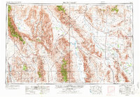
1954 Map of Death Valley
USGS Topo · Published 1966About this map
Death Valley and its surrounding desert ranges appear in this mid-century survey at a time when the region was defined by a mix of early mining remnants and growing federal land management. The map details the transition from the old desert economy of sites like Rhyolite and the Skidoo Mines to the Cold War footprint of the Nevada Test Site and the Naval Ordnance Test Station. Settlement patterns are concentrated around water and mineral sources, ranging from Indian Village and Furnace Creek Ranch to isolated outposts like Stovepipe Wells. The massive verticality of the landscape is recorded between the Panamint Range, featuring Telescope Peak, and the floor of Sarcobatus Flat. Historical transportation infrastructure is visible through the alignment of the Tidewater and Tonopah RR and early desert routes such as State Hwy 190, which connect the remote camps of Ballarat and Chloride City to the wider region.
Find a feature on this map
62 named features on this map. Tap any name to fly to it.
Don’t see what you’re looking for? This feature index may not catch every label — zoom into the map to look around manually.
Map Details
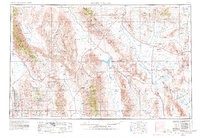
Editions of this 1954 Death Valley Map
Other maps of this area

1905 · Olancha
USGS Topo · 1:125,000

1906 · Kernville
USGS Topo · 1:125,000

1907 · Olancha
USGS Topo · 1:125,000

1907 · Mt. Whitney
USGS Topo · 1:125,000

1907 · Las Vegas
USGS Topo · 1:250,000

1908 · Kawich
USGS Topo · 1:250,000

1908 · Lida
USGS Topo · 1:250,000

1908 · Furnace Creek
USGS Topo · 1:250,000

1908 · Las Vegas
USGS Topo · 1:250,000

1908 · Kernville
USGS Topo · 1:125,000