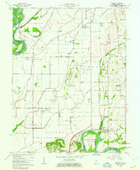
1961 Map of Decker
USGS Topo · Published 1963About this map
The White River and the Wabash River define this corner of Knox County, where the Indiana-Illinois state line follows the winding river channel. The landscape is heavily influenced by water management, featuring a complex network of man-made structures including the Brevoort Levee and various drainage systems such as the Vieke Drainage System Ditch and Plass Ditch. These efforts reclaimed fertile land for agriculture and protected small settlements like Vollmer and Cantaloupe situated near the low-lying bottoms.
Find a feature on this map
53 named features on this map. Tap any name to fly to it.
Don’t see what you’re looking for? This feature index may not catch every label — zoom into the map to look around manually.
Map Details
Editions of this 1961 Decker Map
3 editions found
Other maps of this area

1901 · Princeton
USGS Topo · 1:62,500

1902 · Ditney
USGS Topo · 1:125,000

1903 · Petersburg
USGS Topo · 1:62,500

1903 · Princeton
USGS Topo · 1:62,500

1903 · Patoka
USGS Topo · 1:125,000

1915 · Vincennes
USGS Topo · 1:62,500

1942 · Fritchton
USGS Topo · 1:24,000

1944 · Fritchton
USGS Topo · 1:24,000

1944 · Iona
USGS Topo · 1:24,000

1944 · Vincennes
USGS Topo · 1:62,500