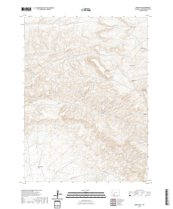
2021 Map of Deer Butte
USGS Topo · Published 2021About this map
The Continental Divide traverses this high-elevation landscape in Sweetwater County, marking a fundamental geological boundary through the Leucite Hills. The terrain is defined by dramatic volcanic and erosional formations, including the prominent landmark of Deer Butte and the distinctive outcroppings at Twin Rocks. To the south, the land descends toward the North Baxter Basin, a region historically significant for its natural gas resources.
Find a feature on this map
14 named features on this map. Tap any name to fly to it.
Don’t see what you’re looking for? This feature index may not catch every label — zoom into the map to look around manually.
Map Details
Editions of this 2021 Deer Butte Map
This is the sole edition of this map. No revisions or reprints were ever made.
Other maps of this area

1908 · Rock Springs
USGS Topo · 1:62,500

1910 · Rock Springs
USGS Topo · 1:62,500

1954 · Rock Springs
USGS Topo · 1:250,000

1958 · Rock Springs
USGS Topo · 1:250,000

1958 · Boars Tusk
USGS Topo · 1:62,500

1958 · Superior
USGS Topo · 1:62,500

1962 · Rock Springs
USGS Topo · 1:250,000

1968 · North Baxter
USGS Topo · 1:24,000
1968 · Reliance
USGS Topo · 1:24,000
1968 · Thayer Junction
USGS Topo · 1:24,000