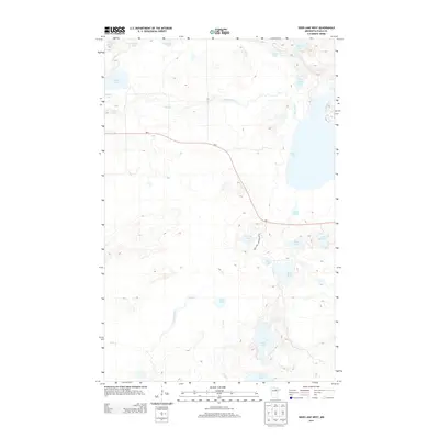
2013 Map of Deer Lake West
USGS Topo · Published 2013About this map
Bass Lake and its surrounding wetlands dominate this 2013 topographical study of the Northwoods, showcasing a landscape defined by glacial hydrology. The area is crisscrossed by a network of drainage systems, including Deer Creek and Coon Cr, which link several large water bodies like Deer Lake and Busties Lake. The map reveals a remote region where the human imprint is largely limited to transportation corridors like MN-1 and Bass Lake Campground Rd. These routes provide access to the various shorelines and recreational areas such as Lake Erskine and Larson Lake. This survey is particularly useful for understanding the modern drainage patterns and the distribution of smaller water features like Spike Lake, Barrett Lake, and Thimble Lake across the northern Minnesota terrain.
Find a feature on this map
23 named features on this map. Tap any name to fly to it.
Don’t see what you’re looking for? This feature index may not catch every label — zoom into the map to look around manually.
Map Details
Editions of this 2013 Deer Lake West Map
This is the sole edition of this map. No revisions or reprints were ever made.
Other maps of this area

1919 · Release
USGS Topo · 1:62,500

1919 · Marcell
USGS Topo · 1:62,500

1943 · Release
USGS Topo · 1:62,500

1954 · Hibbing
USGS Topo · 1:250,000

1957 · Hibbing
USGS Topo · 1:250,000

1958 · Hibbing
USGS Topo · 1:250,000

1964 · Hibbing
USGS Topo · 1:250,000

1970 · Coon Lake
USGS Topo · 1:24,000

1970 · Deer Lake East
USGS Topo · 1:24,000
1970 · Anderson Lake
USGS Topo · 1:24,000