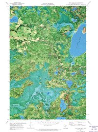
1970 Map of Deer Lake West
USGS Topo · Published 1973About this map
George Washington State Forest dominates this 1970s orthophotomap, showing a dense mosaic of timberland and glacial lakes in Itasca County. The use of aerial photography rather than traditional topographic line work highlights the intricate shoreline of Deer Lake and the smaller neighboring basins like Busties Lake and Bass Lake. A seasonal Winter Trail snakes through the northern woods, indicating the area's historical reliance on frozen ground for transportation and logging access. Several recreation sites are visible, including a Campground on the shores of Duck Lake and Bass Lake. The map reveals a landscape defined by water and forest management, where small water bodies such as Sucker Lake, Rice Lake, and Beaver Lake are interspersed with state-protected lands, reflecting the region's character as a timber and outdoor recreation hub before significant modern development.
Find a feature on this map
22 named features on this map. Tap any name to fly to it.
Don’t see what you’re looking for? This feature index may not catch every label — zoom into the map to look around manually.
Map Details
Editions of this 1970 Deer Lake West Map
This is the sole edition of this map. No revisions or reprints were ever made.
Other maps of this area

1919 · Release
USGS Topo · 1:62,500

1919 · Marcell
USGS Topo · 1:62,500

1943 · Release
USGS Topo · 1:62,500

1954 · Hibbing
USGS Topo · 1:250,000

1957 · Hibbing
USGS Topo · 1:250,000

1958 · Hibbing
USGS Topo · 1:250,000

1964 · Hibbing
USGS Topo · 1:250,000

1970 · Coon Lake
USGS Topo · 1:24,000

1970 · Deer Lake East
USGS Topo · 1:24,000
1970 · Anderson Lake
USGS Topo · 1:24,000