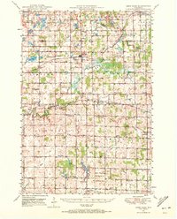
1950 Map of Deer Park
USGS Topo · Published 1972About this map
Dairy farming and rail transport defined the St. Croix and Polk County borderlands at mid-century, as seen in this 1950s-era landscape. Small agricultural hubs like Deer Park and Cylon serve as focal points for a network of rural school districts, including Jewett Mills Sch and High Landing Sch, which illustrate the community-centered layout of the era. The presence of both the Chicago and North Western and the Minneapolis St Paul and Sault Ste Marie railroads underscores the region's historical importance as a transit corridor for goods and passengers moving through western Wisconsin.
Find a feature on this map
67 named features on this map. Tap any name to fly to it.
Don’t see what you’re looking for? This feature index may not catch every label — zoom into the map to look around manually.
Map Details
Editions of this 1950 Deer Park Map
2 editions found

Other maps of this area

1900 · St Croix Dalles
USGS Topo · 1:62,500

1901 · St Croix Dalles
USGS Topo · 1:62,500

1946 · Knapp
USGS Topo · 1:62,500

1946 · River Falls
USGS Topo · 1:62,500

1948 · New Richmond
USGS Topo · 1:62,500

1948 · Downing
USGS Topo · 1:62,500

1949 · New Richmond
USGS Topo · 1:62,500

1949 · River Falls
USGS Topo · 1:62,500

1949 · Knapp
USGS Topo · 1:62,500

1949 · Baldwin
USGS Topo · 1:62,500