
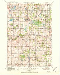
1950 Map of Deer Park
USGS Topo · Published 1950About this map
Deer Park and the surrounding townships of Alden and Black Brook anchor this mid-century portrait of northwestern Wisconsin. The landscape is defined by the winding course of the Willow River and its various tributaries, including the South Fork and Hutton Creek. The rail-centered economies of the 1940s are evident in the corridors of the Chicago and North Western and the Minneapolis St Paul and Sault Ste Marie railroads, which connect rural hubs like Cylon, Stanton, and Emerald.
Find a feature on this map
73 named features on this map. Tap any name to fly to it.
Don’t see what you’re looking for? This feature index may not catch every label — zoom into the map to look around manually.
Map Details
Editions of this 1950 Deer Park Map
2 editions found
Other maps of this area

1900 · St Croix Dalles
USGS Topo · 1:62,500

1901 · St Croix Dalles
USGS Topo · 1:62,500

1946 · Knapp
USGS Topo · 1:62,500

1946 · River Falls
USGS Topo · 1:62,500

1948 · New Richmond
USGS Topo · 1:62,500

1948 · Downing
USGS Topo · 1:62,500

1949 · New Richmond
USGS Topo · 1:62,500

1949 · River Falls
USGS Topo · 1:62,500

1949 · Knapp
USGS Topo · 1:62,500

1949 · Baldwin
USGS Topo · 1:62,500