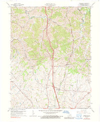
1965 Map of Delaplain
USGS Topo · Published 1989About this map
The Southern railroad corridor anchors this mid-century landscape in Scott County, cutting a straight north-south path through the rolling Kentucky terrain. Small rural communities like Delaplain and Rogers Gap appear at crossroads and rail sidings, reflecting the decentralized settlement patterns typical of the Bluegrass region before modern suburban expansion. The map is particularly rich in family-named watercourses such as McCracken Creek, Burgess Creek, and Griffith Br, which serve as vital landmarks for local history researchers tracing property boundaries or genealogical roots.
Find a feature on this map
39 named features on this map. Tap any name to fly to it.
Don’t see what you’re looking for? This feature index may not catch every label — zoom into the map to look around manually.
Map Details
Editions of this 1965 Delaplain Map
3 editions found
Other maps of this area

1906 · Georgetown
USGS Topo · 1:62,500

1908 · Georgetown
USGS Topo · 1:62,500

1927 · Lexington
USGS Topo · 1:48,000

1929 · Cynthiana
USGS Topo · 1:48,000

1929 · Lexington
USGS Topo · 1:62,500

1934 · Cynthiana
USGS Topo · 1:62,500

1939 · Sadieville
USGS Topo · 1:62,500

1952 · Midway
USGS Topo · 1:24,000

1953 · Sadieville
USGS Topo · 1:24,000

1953 · Breckinridge
USGS Topo · 1:24,000