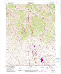
1965 Map of Delaplain
USGS Topo · Published 1993About this map
Eagle Creek and its many tributaries, including Griffith Br and Wolf Branch, carve through the northern Bluegrass landscape in this record of Scott County. The area shows a distinct shift from the traditional agricultural crossroads like Oxford and Biddle toward modern residential and transit infrastructure. The corridor along Interstate 75 features significant industrial and commercial development around Delaplain, including large-scale structures and Weighing Stations. Historic community centers are anchored by landmarks such as Mt Olive Ch and Dry Run Ch, while the Southern railroad line skirts the eastern edge near Rogers Gap. This map specifically highlights later 20th-century growth through purple-shaded revisions, showing the expansion of settlements like Mallard Point and Moon Lake Estates against the established rural grid of Gaines Road and Old Oxford Rd.
Find a feature on this map
45 named features on this map. Tap any name to fly to it.
Don’t see what you’re looking for? This feature index may not catch every label — zoom into the map to look around manually.
Map Details
Editions of this 1965 Delaplain Map
3 editions found
Other maps of this area

1906 · Georgetown
USGS Topo · 1:62,500

1908 · Georgetown
USGS Topo · 1:62,500

1927 · Lexington
USGS Topo · 1:48,000

1929 · Cynthiana
USGS Topo · 1:48,000

1929 · Lexington
USGS Topo · 1:62,500

1934 · Cynthiana
USGS Topo · 1:62,500

1939 · Sadieville
USGS Topo · 1:62,500

1952 · Midway
USGS Topo · 1:24,000

1953 · Sadieville
USGS Topo · 1:24,000

1953 · Breckinridge
USGS Topo · 1:24,000