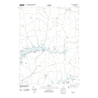
2010 Map of Dellroy
USGS Topo · Published 2010About this map
Atwood Lake and Leesville Lake dominate this portion of Carroll County, defining a landscape of recreational development and established crossroads. The village of Dellroy, centrally located near the eastern shore of the reservoir, serves as a hub with its own Dellroy Post Office and nearby Dellroy Creek. The shoreline is heavily partitioned into residential clusters such as Atwood Pines, Pines Cottage Area, and Arrowhead, reflecting the area's mid-century transition into a prominent regional retreat. Farther south, Leavittsville and Queensboro mark older interior settlements. For genealogists, the map is remarkably dense with burial grounds, including the Old Scott Cemetery, McGuire Cemetery, and Price-Rollins Cemetery, which anchor the history of early families long before the creation of the nearby dams and reservoirs.
Find a feature on this map
115 named features on this map. Tap any name to fly to it.
Don’t see what you’re looking for? This feature index may not catch every label — zoom into the map to look around manually.
Map Details
Editions of this 2010 Dellroy Map
This is the sole edition of this map. No revisions or reprints were ever made.
Other maps of this area

1902 · Scio
USGS Topo · 1:62,500

1904 · Scio
USGS Topo · 1:62,500

1909 · Uhrichsville
USGS Topo · 1:62,500

1910 · Carrollton
USGS Topo · 1:62,500

1911 · Uhrichsville
USGS Topo · 1:62,500

1912 · Dover
USGS Topo · 1:62,500

1912 · Carrollton
USGS Topo · 1:62,500

1944 · Dover
USGS Topo · 1:62,500

1951 · Canton
USGS Topo · 1:250,000

1953 · Canton
USGS Topo · 1:250,000