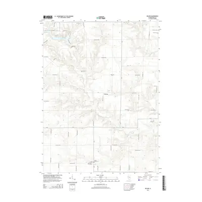
2015 Map of DeLong
USGS Topo · Published 2015About this map
Lake Bracken serves as a prominent landmark in the northwest corner of this Knox County landscape, where the waters of Brush Cr and Brunk Cr drain through the local drainage network. The area is characterized by a sparse, rural settlement pattern typical of western Illinois, with the small unincorporated communities of DeLong and Hermon serving as primary hubs. For genealogists and local historians, the sheet is notably rich in family and community burial sites, including the Hermon Christian Cem, Elias Bragg Cem, and Ferguson Cem. The road network, dominated by routes like Steakhouse Rd and various numbered county roads, follows the traditional township and range grid, while the irregular courses of Hermon Cr and Haw Cr provide a natural contrast to the surveyed landscape.
Find a feature on this map
59 named features on this map. Tap any name to fly to it.
Don’t see what you’re looking for? This feature index may not catch every label — zoom into the map to look around manually.
Map Details
Editions of this 2015 DeLong Map
This is the sole edition of this map. No revisions or reprints were ever made.
Other maps of this area

1912 · Canton
USGS Topo · 1:62,500

1915 · Avon
USGS Topo · 1:62,500

1925 · Galesburg
USGS Topo · 1:62,500

1927 · Galesburg
USGS Topo · 1:62,500

1941 · Maquon
USGS Topo · 1:62,500

1943 · Maquon
USGS Topo · 1:62,500

1944 · Avon
USGS Topo · 1:62,500

1958 · Burlington
USGS Topo · 1:250,000

1961 · Burlington
USGS Topo · 1:250,000

1963 · Burlington
USGS Topo · 1:250,000