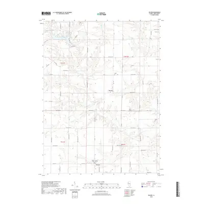
2018 Map of DeLong
USGS Topo · Published 2018About this map
Lake Bracken anchors the northwestern corner of this Knox County landscape, where the residential development of Hillbrook Estate sits along the winding drainage of Brush Cr. The terrain is defined by a dense network of small waterways, including Brunk Cr, Pig Cr, and Hermon Cr, which carve into the agricultural plateaus of Cedar and Orange Townships.
Find a feature on this map
70 named features on this map. Tap any name to fly to it.
Don’t see what you’re looking for? This feature index may not catch every label — zoom into the map to look around manually.
Map Details
Editions of this 2018 DeLong Map
This is the sole edition of this map. No revisions or reprints were ever made.
Other maps of this area

1912 · Canton
USGS Topo · 1:62,500

1915 · Avon
USGS Topo · 1:62,500

1925 · Galesburg
USGS Topo · 1:62,500

1927 · Galesburg
USGS Topo · 1:62,500

1941 · Maquon
USGS Topo · 1:62,500

1943 · Maquon
USGS Topo · 1:62,500

1944 · Avon
USGS Topo · 1:62,500

1958 · Burlington
USGS Topo · 1:250,000

1961 · Burlington
USGS Topo · 1:250,000

1963 · Burlington
USGS Topo · 1:250,000