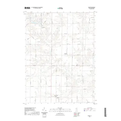
2021 Map of DeLong
USGS Topo · Published 2021About this map
The unincorporated settlement of DeLong and the surrounding farmland of Knox County characterize this modern topographic study. The landscape is defined by the intricate dendritic drainage systems of Brush Creek, Indian Cr, and Hermon Cr, which carve through the prairie terrain towards the reservoir of Lake Bracken in the northwest. This water body, flanked by the residential Hillbrook Estate and reached via Sunset View Dr, serves as a primary local landmark in an area otherwise dedicated to agriculture and rural homesteads.
Find a feature on this map
68 named features on this map. Tap any name to fly to it.
Don’t see what you’re looking for? This feature index may not catch every label — zoom into the map to look around manually.
Map Details
Editions of this 2021 DeLong Map
This is the sole edition of this map. No revisions or reprints were ever made.
Other maps of this area

1912 · Canton
USGS Topo · 1:62,500

1915 · Avon
USGS Topo · 1:62,500

1925 · Galesburg
USGS Topo · 1:62,500

1927 · Galesburg
USGS Topo · 1:62,500

1941 · Maquon
USGS Topo · 1:62,500

1943 · Maquon
USGS Topo · 1:62,500

1944 · Avon
USGS Topo · 1:62,500

1958 · Burlington
USGS Topo · 1:250,000

1961 · Burlington
USGS Topo · 1:250,000

1963 · Burlington
USGS Topo · 1:250,000