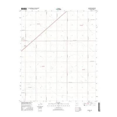
2017 Map of Delphos
USGS Topo · Published 2017About this map
Delphos sits in the northwest quadrant of this landscape, a small community point in a region defined by an extensive, regular grid of agricultural roads. This High Plains section of Roosevelt County is mapped near the transition between t2s r33e and t3s r34e, illustrating a land use pattern dominated by large-scale farming or ranching. The terrain is relatively flat, marked primarily by the intersection of thoroughfares like S Roosevelt Road 12 and S Roosevelt Rd AB. A diagonal rail line or highway cuts through the northwestern corner, providing a sharp contrast to the cardinal-direction road network. Genealogists and local historians can use this survey to pinpoint specific sections and properties along rural routes such as S Roosevelt Rd 11 and S Roosevelt Road 10.
Find a feature on this map
19 named features on this map. Tap any name to fly to it.
Don’t see what you’re looking for? This feature index may not catch every label — zoom into the map to look around manually.
Map Details
Editions of this 2017 Delphos Map
This is the sole edition of this map. No revisions or reprints were ever made.
Other maps of this area

1954 · Clovis
USGS Topo · 1:250,000

1954 · Brownfield
USGS Topo · 1:250,000

1957 · Portales
USGS Topo · 1:62,500

1958 · Brownfield
USGS Topo · 1:250,000

1958 · Clovis
USGS Topo · 1:250,000

1962 · Brownfield
USGS Topo · 1:250,000

1972 · Dora NW
USGS Topo · 1:24,000

1972 · Dora
USGS Topo · 1:24,000

1973 · Floyd
USGS Topo · 1:24,000

1973 · Floyd SE
USGS Topo · 1:24,000