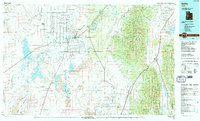
1989 Map of Delta
USGS Topo · Published 1989About this map
Delta and its surrounding agricultural communities serve as the hub for this West Central Utah landscape, where the Sevier River snakes toward the expansive Sevier Lake and Mud Lake. The map illustrates a complex irrigation and water management system essential for Great Basin settlement, including the Gunnison Bend Reservoir, DMAD Reservoir, and Topaz Slough. To the east, the terrain rises sharply into the Pahvant Range and Canyon Mountains within the Fishlake National Forest, providing a stark contrast to the flat expanses of Pahvant Valley.
Find a feature on this map
53 named features on this map. Tap any name to fly to it.
Don’t see what you’re looking for? This feature index may not catch every label — zoom into the map to look around manually.
Map Details
Editions of this 1989 Delta Map
2 editions found
Other maps of this area

1885 · Manti
USGS Topo · 1:250,000

1885 · Beaver
USGS Topo · 1:250,000

1885 · Sevier Desert
USGS Topo · 1:250,000

1885 · Fish Lake
USGS Topo · 1:250,000

1895 · Manti
USGS Topo · 1:250,000

1896 · Fish Lake
USGS Topo · 1:250,000

1908 · Fish Springs
USGS Topo · 1:250,000

1910 · Fish Springs
USGS Topo · 1:250,000

1951 · Oak City
USGS Topo · 1:62,500

1951 · Nephi
USGS Topo · 1:62,500