
1962 Map of Denman
USGS Topo · Published 1963About this map
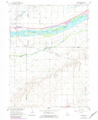
The braided waters of the Platte River dominate this 1960s landscape, where the North Channel Platte River, Middle Channel Platte River, and South Channel Platte River create the expansive Platte Island. This complex fluvial system is flanked by the intensive agricultural lands of Buffalo, Hall, Kearney, and Adams counties. The tiny settlement of Denman sits at a rail junction where the Union Pacific line crosses the river plains, while further south, the town of Kenesaw is positioned along the Chicago Burlington and Quincy railroad.
Find a feature on this map
20 named features on this map. Tap any name to fly to it.
Don’t see what you’re looking for? This feature index may not catch every label — zoom into the map to look around manually.
Map Details
Editions of this 1962 Denman Map
3 editions found
Other maps of this area

1894 · Kenesaw
USGS Topo · 1:62,500

1894 · Minden
USGS Topo · 1:62,500

1895 · Wood River
USGS Topo · 1:62,500

1896 · Wood River
USGS Topo · 1:125,000

1955 · Grand Island
USGS Topo · 1:250,000

1957 · Grand Island
USGS Topo · 1:250,000

1958 · Grand Island
USGS Topo · 1:250,000

1962 · Prosser
USGS Topo · 1:24,000
1962 · Gibbon North
USGS Topo · 1:24,000
1962 · Shelton
USGS Topo · 1:24,000