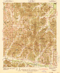
1943 Map of Denmark
USGS Topo · Published 1943About this map
Holly Springs National Forest dominates the upper half of this 1943 edition, showing the complex drainage systems of Cypress Creek and Puskus Creek as they cut through the northern hills. The landscape is a network of rural schoolhouses and churches that served as the primary social anchors for dispersed farming communities during the early 1940s. Many of these sites, such as Denmark Sch and Caswell Sch, are documented alongside family and community burial grounds like Cypress Cem and Liberty Hill Cem.
Find a feature on this map
105 named features on this map. Tap any name to fly to it.
Don’t see what you’re looking for? This feature index may not catch every label — zoom into the map to look around manually.
Map Details
Editions of this 1943 Denmark Map
3 editions found
Other maps of this area

1940 · Oxford
USGS Topo · 1:62,500

1942 · Denmark
USGS Topo · 1:62,500

1943 · Denmark
USGS Topo · 1:62,500

1943 · Oxford
USGS Topo · 1:62,500

1944 · Tyro
USGS Topo · 1:62,500

1944 · Potts Camp
USGS Topo · 1:62,500

1945 · Potts Camp
USGS Topo · 1:62,500

1949 · New Albany
USGS Topo · 1:62,500

1951 · New Albany
USGS Topo · 1:62,500

1954 · Water Valley
USGS Topo · 1:62,500