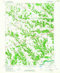
1964 Map of Dennison
USGS Topo · Published 1965About this map
The Pennsylvania railroad corridor dictates the settlement pattern of this borderland landscape, linking the communities of Dennison, McKeen, and Farrington. This survey captures the rural character of the Illinois-Indiana state line just before the mid-1960s, where the terrain transitions from the upland farming of Elbridge to the broad Wabash Valley in the south. Local life is centered around country crossroads and small houses of worship such as Mt Moriah Ch and Dunlap Ch. The physical geography is defined by the incision of Sugar Creek, Hawks Creek, and Crooked Creek into the prairie, creating a web of wooded ravines that isolate small farmsteads. Near the southeastern corner, the Wabash River and the flat expanse of Prairieton appear, while scattered Oil Wells indicate the subterranean resource extraction typical of the era.
Find a feature on this map
41 named features on this map. Tap any name to fly to it.
Don’t see what you’re looking for? This feature index may not catch every label — zoom into the map to look around manually.
Map Details
Editions of this 1964 Dennison Map
3 editions found
Other maps of this area

1932 · Marshall
USGS Topo · 1:62,500

1937 · Marshall
USGS Topo · 1:62,500

1940 · Pimento
USGS Topo · 1:24,000

1941 · Terre Haute
USGS Topo · 1:24,000

1942 · Hutton
USGS Topo · 1:24,000

1942 · Dennison
USGS Topo · 1:24,000

1947 · Paris
USGS Topo · 1:62,500

1948 · Terre Haute
USGS Topo · 1:24,000

1949 · Paris
USGS Topo · 1:62,500

1950 · New Goshen
USGS Topo · 1:24,000