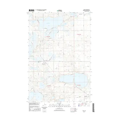
2016 Map of Dent
USGS Topo · Published 2016About this map
Dent and Richville anchor this portion of Otter Tail County, where a dense network of glacial lakes defines the human geography. The landscape is dominated by large water bodies such as Little McDonald Lake and Marion Lake, which are surrounded by a intricate web of local roads like W Little McDonald Dr and Co Hwy 34. This pattern suggests a transition from traditional lakeside agriculture to seasonal and residential shoreline development. Notable local landmarks include the Aerovilla Airport near the northeastern corner and a high concentration of community burial sites, including Sacred Heart Cem, Immanuel Cem, and Pleasant Hill Cem. These sites, clustered near the settlements and scattered among the lake shores, provide essential reference points for genealogical research and local historical mapping in a region where the water often dictates the placement of infrastructure.
Find a feature on this map
100 named features on this map. Tap any name to fly to it.
Don’t see what you’re looking for? This feature index may not catch every label — zoom into the map to look around manually.
Map Details
Editions of this 2016 Dent Map
This is the sole edition of this map. No revisions or reprints were ever made.
Other maps of this area

1912 · Vergas
USGS Topo · 1:62,500

1912 · Battle Lake
USGS Topo · 1:62,500

1914 · Battle Lake
USGS Topo · 1:62,500

1915 · Underwood
USGS Topo · 1:62,500

1915 · Perham
USGS Topo · 1:62,500

1915 · Vergas
USGS Topo · 1:62,500

1953 · Brainerd
USGS Topo · 1:250,000

1957 · Brainerd
USGS Topo · 1:250,000

1958 · Brainerd
USGS Topo · 1:250,000

1965 · Brainerd
USGS Topo · 1:250,000