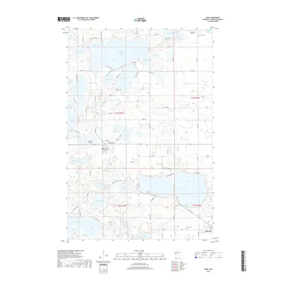
2019 Map of Dent
USGS Topo · Published 2019About this map
Glacial geology defines this portion of Otter Tail County, where dozens of named basins create a dense network of water bodies. The village of Dent serves as a local hub near the center of the sheet, while the smaller settlement of Richville is situated in the southeast corner near Richville Cem. The landscape is a mosaic of wetlands and ridges, with family and community history preserved at several burial sites including Pleasant Hill Cem, Sacred Heart Cem, and Immanuel Cem.
Find a feature on this map
98 named features on this map. Tap any name to fly to it.
Don’t see what you’re looking for? This feature index may not catch every label — zoom into the map to look around manually.
Map Details
Editions of this 2019 Dent Map
This is the sole edition of this map. No revisions or reprints were ever made.
Other maps of this area

1912 · Vergas
USGS Topo · 1:62,500

1912 · Battle Lake
USGS Topo · 1:62,500

1914 · Battle Lake
USGS Topo · 1:62,500

1915 · Underwood
USGS Topo · 1:62,500

1915 · Perham
USGS Topo · 1:62,500

1915 · Vergas
USGS Topo · 1:62,500

1953 · Brainerd
USGS Topo · 1:250,000

1957 · Brainerd
USGS Topo · 1:250,000

1958 · Brainerd
USGS Topo · 1:250,000

1965 · Brainerd
USGS Topo · 1:250,000