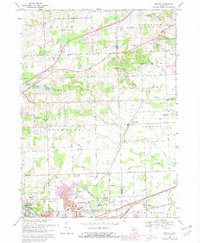
1969 Map of Denton
USGS Topo · Published 1981About this map
The boundary of Washtenaw and Wayne County forms the central spine of this landscape, where the agricultural past meets the expanding post-war infrastructure of southeastern Michigan. The western edge is defined by the city of Ypsilanti and the sprawling campus of Washtenaw Community College, while the Huron River and the extensive Willow Run complex dominate the southern reach. The map captures a mix of small crossroads communities like Cherry Hill and Denton, alongside institutional landmarks such as Ridgewood Hospital and United Memorial Gardens.
Find a feature on this map
56 named features on this map. Tap any name to fly to it.
Don’t see what you’re looking for? This feature index may not catch every label — zoom into the map to look around manually.
Map Details
Editions of this 1969 Denton Map
4 editions found
Other maps of this area

1902 · South Lyon
USGS Topo · 1:62,500

1902 · Ypsilanti
USGS Topo · 1:62,500

1904 · Ann Arbor
USGS Topo · 1:125,000

1905 · Wayne
USGS Topo · 1:62,500

1906 · Ypsilanti
USGS Topo · 1:62,500

1906 · South Lyon
USGS Topo · 1:62,500

1906 · Romulus
USGS Topo · 1:62,500

1908 · Ann Arbor
USGS Topo · 1:125,000

1912 · Wayne
USGS Topo · 1:62,500

1928 · Romulus
USGS Topo · 1:62,500
Featured Places
- Canton Township, MI
- Ypsilanti Charter Township, MI
- Van Buren Charter Township, MI
- Plymouth Charter Township, MI
- Ypsilanti, MI