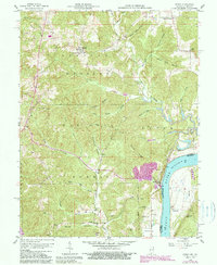
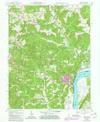
1958 Map of Derby
USGS Topo · Published 1989About this map
The Ohio River forms a grand sweeping bend at the border of Indiana and Kentucky, serving as the dominant geographic feature of this mid-century survey. On the Indiana side, the Hoosier National Forest covers much of the land, characterized by a series of prominent ridges such as Mogan Ridge and Kuntz Ridge. The small riverfront community of Derby sits tucked against the water, while further inland, the settlement of Leopold is anchored by the St Augustinus Ch.
Find a feature on this map
50 named features on this map. Tap any name to fly to it.
Don’t see what you’re looking for? This feature index may not catch every label — zoom into the map to look around manually.
Map Details
Editions of this 1958 Derby Map
5 editions found
Other maps of this area

1928 · Hardinsburg
USGS Topo · 1:48,000

1931 · Hardinsburg
USGS Topo · 1:62,500

1934 · Cannelton
USGS Topo · 1:62,500

1947 · Lodiburg
USGS Topo · 1:24,000

1947 · Hardinsburg
USGS Topo · 1:62,500

1949 · Cannelton
USGS Topo · 1:24,000

1950 · Beechwood
USGS Topo · 1:24,000

1950 · Alton
USGS Topo · 1:62,500

1950 · Alton
USGS Topo · 1:24,000

1951 · Alton
USGS Topo · 1:24,000