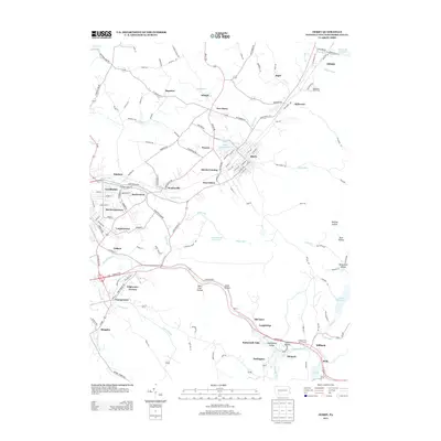
2013 Map of Derry
USGS Topo · Published 2013About this map
Chestnut Ridge dominates the eastern landscape of this Westmoreland County study, rising above a network of small coal and industrial settlements. The borough of Derry serves as a focal point, situated near Ethel Springs Lake and the smaller hamlets of Peanut and Burds Crossing. The southern portion of the map is defined by the Loyalhanna Creek, which carves through the Loyalhanna Gorge, passing Buttermilk Falls and the community of Idlepark. This area demonstrates a dense cluster of naming conventions tied to the local geography, with numerous hollows like Rock Hollow and Saint Clair Hollow branching off the primary watercourses. The transportation network is anchored by the Lincoln Hwy and State Route 217, connecting older centers like Youngstown and New Derry with specialized sites such as the Kennametal Reservoir and Latrobe Reservoir.
Find a feature on this map
143 named features on this map. Tap any name to fly to it.
Don’t see what you’re looking for? This feature index may not catch every label — zoom into the map to look around manually.
Map Details
Editions of this 2013 Derry Map
This is the sole edition of this map. No revisions or reprints were ever made.
Other maps of this area

1900 · Latrobe
USGS Topo · 1:62,500

1902 · Latrobe
USGS Topo · 1:62,500

1903 · Latrobe
USGS Topo · 1:62,500

1913 · Somerset
USGS Topo · 1:62,500

1915 · Somerset
USGS Topo · 1:62,500

1920 · New Florence
USGS Topo · 1:62,500

1921 · New Florence
USGS Topo · 1:48,000

1922 · Donegal
USGS Topo · 1:62,500

1922 · New Florence
USGS Topo · 1:62,500

1935 · Donegal
USGS Topo · 1:62,500