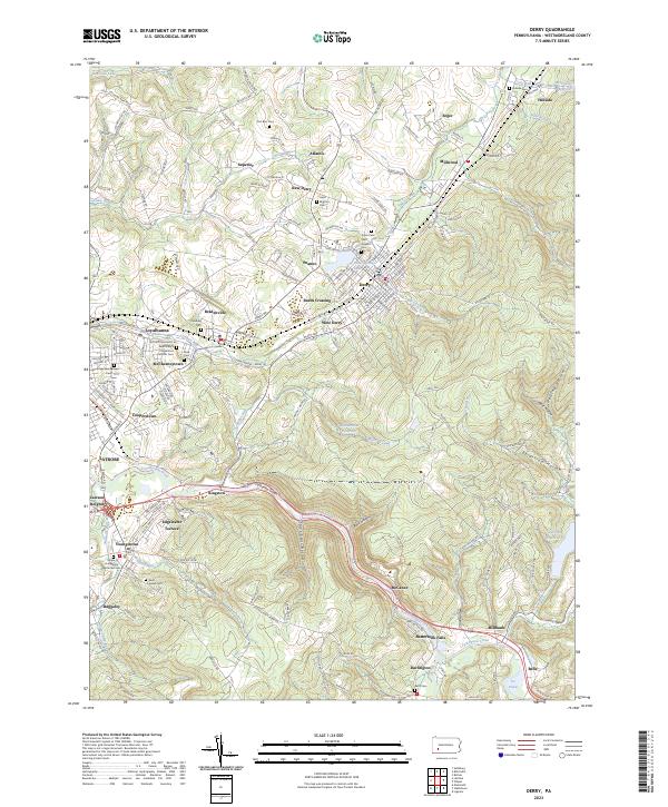
2023 Map of Derry
USGS Topo · Published 2023About this map
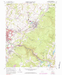
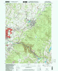
Derry and its surrounding coal and rail communities in Westmoreland County are defined by the winding course of Loyalhanna Creek and the steep elevation of Derry Ridge. The landscape is a complex network of industrial-era settlements and religious landmarks, where the Norfolk Southern line cuts through the Loyalhanna Gorge to connect centers like West Derry, Bradenville, and Loyalhanna. Numerous cemeteries, such as Saint Mary's Byzantine Catholic Cem and Fort Barr Cem, are scattered across the hillsides, reflecting the diverse heritage of the families who settled this part of the Appalachian plateau. Water management is central to the area, evidenced by the Kennametal Reservoir, Latrobe Reservoir, and the older Blairsville Reservoir. The map captures the interface between dense residential clusters like McChesneytown and the deep, wooded incisions of Rock Hollow and Saint Clair Hollow.
Find a feature on this map
181 named features on this map. Tap any name to fly to it.
Don’t see what you’re looking for? This feature index may not catch every label — zoom into the map to look around manually.
Map Details
Editions of this 2023 Derry Map
This is the sole edition of this map. No revisions or reprints were ever made.
Historical Maps of Pandora Through Time
3 maps found