1998 Map of Derry
USGS Topo · Published 2000About this map
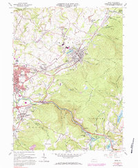
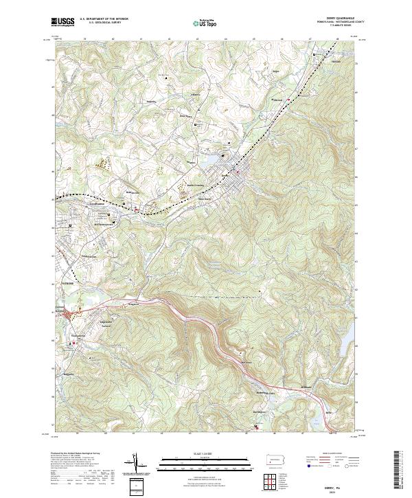
Chestnut Ridge dominates this late twentieth-century landscape, carving a prominent northeast-southwest path between the industrial and residential hubs of Derry and Latrobe. The map reveals a high concentration of coal-era infrastructure, with numerous labels for Strip Mines and the Conrail line supporting the region's transport network. Moving south, Loyalhanna Creek meanders through the terrain toward Buttermilk Falls, while localized settlements like New Derry, Peanut, and Millwood are clearly defined. Local history is anchored by landmarks such as St Martins Ch, Sacred Heart Sch, and the older Coles Cem, providing essential points of reference for genealogists. The presence of Keystone State Park and Ethel Springs Lake illustrates the balance between the region's extractive industrial past and its recreational land use at the turn of the millennium.
Find a feature on this map
72 named features on this map. Tap any name to fly to it.
Don’t see what you’re looking for? This feature index may not catch every label — zoom into the map to look around manually.
Map Details
Editions of this 1998 Derry Map
This is the sole edition of this map. No revisions or reprints were ever made.
Historical Maps of Latrobe Through Time
7 maps found