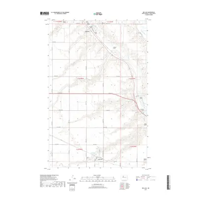
2017 Map of Des Lacs
USGS Topo · Published 2017About this map
The Des Lacs River valley defines the topography of this Ward County landscape, where the prairie is carved by a complex system of drainage ravines. These coulees, including Lonetree Coulee and Tasker Coulee, suggest the deep erosion patterns characteristic of the Souris River basin. The settlement of Des Lacs anchors the southern portion of the map near the Des Lacs Reservoir, while the smaller community of Foxholm is situated to the north along the river's winding path.
Find a feature on this map
46 named features on this map. Tap any name to fly to it.
Don’t see what you’re looking for? This feature index may not catch every label — zoom into the map to look around manually.
Map Details
Editions of this 2017 Des Lacs Map
This is the sole edition of this map. No revisions or reprints were ever made.
Other maps of this area

1928 · Minot
USGS Topo · 1:62,500

1948 · Burlington
USGS Topo · 1:24,000

1948 · Burlington
USGS Topo · 1:62,500

1948 · Minot NW
USGS Topo · 1:24,000

1949 · Burlington NW
USGS Topo · 1:24,000

1949 · Minot NW
USGS Topo · 1:24,000

1949 · Carpio NE
USGS Topo · 1:24,000

1949 · Carpio
USGS Topo · 1:24,000

1950 · Des Lacs
USGS Topo · 1:24,000
1950 · Burlington
USGS Topo · 1:24,000