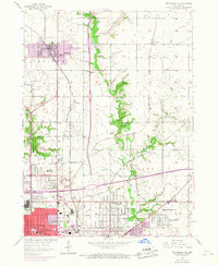
1956 Map of Des Moines NE
USGS Topo · Published 1968About this map
The northern expansion of Des Moines into Saylor and Delaware townships is documented here through a complex web of industrial and suburban growth. The landscape is defined by the heavy rail infrastructure of the Chicago and North Western and Chicago Great Western railroads, which facilitated the development of outlying settlements like Ankeny and Oralabor. Revisions from 1967 highlight the rapid evolution of the corridor, specifically the massive footprint of Interstate 35 and 80 cutting across the southern portion of the sheet.
Find a feature on this map
49 named features on this map. Tap any name to fly to it.
Don’t see what you’re looking for? This feature index may not catch every label — zoom into the map to look around manually.
Map Details
Editions of this 1956 Des Moines NE Map
4 editions found

Other maps of this area

1905 · Des Moines
USGS Topo · 1:62,500

1907 · Des Moines
USGS Topo · 1:62,500

1911 · Slater
USGS Topo · 1:62,500

1913 · Slater
USGS Topo · 1:62,500

1930 · Mitchellville
USGS Topo · 1:62,500

1954 · Des Moines
USGS Topo · 1:250,000

1956 · Des Moines
USGS Topo · 1:250,000

1956 · Des Moines NW
USGS Topo · 1:24,000

1956 · Des Moines SW
USGS Topo · 1:24,000

1956 · Des Moines SE
USGS Topo · 1:24,000