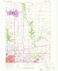
1956 Map of Des Moines NE
USGS Topo · Published 1972About this map
Ankeny and the northern outskirts of Des Moines represent a landscape in transition on this 1956 survey, which was updated with purple revisions from the late 1960s and early 1970s. The northern corridor is defined by the Chicago and North Western and Chicago Rock Island and Pacific railroads, which served early industrial and agricultural hubs like Oralabor and Enterprise. The drainage of Fourmile Creek and Muchikinock Creek provides a natural counterpoint to the growing urban footprint, particularly around the established neighborhoods of Saylor and Marquisville.
Find a feature on this map
47 named features on this map. Tap any name to fly to it.
Don’t see what you’re looking for? This feature index may not catch every label — zoom into the map to look around manually.
Map Details
Editions of this 1956 Des Moines NE Map
4 editions found

Other maps of this area

1905 · Des Moines
USGS Topo · 1:62,500

1907 · Des Moines
USGS Topo · 1:62,500

1911 · Slater
USGS Topo · 1:62,500

1913 · Slater
USGS Topo · 1:62,500

1930 · Mitchellville
USGS Topo · 1:62,500

1954 · Des Moines
USGS Topo · 1:250,000

1956 · Des Moines
USGS Topo · 1:250,000

1956 · Des Moines NW
USGS Topo · 1:24,000

1956 · Des Moines SW
USGS Topo · 1:24,000

1956 · Des Moines SE
USGS Topo · 1:24,000