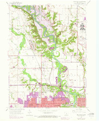
1956 Map of Des Moines NW
USGS Topo · Published 1972About this map
Camp Dodge Military Reservation dominates the northwestern landscape of this Iowa survey, illustrating the significant military presence north of Des Moines. The topography is defined by the winding course of the Des Moines River, where the Saylorville Dam (Under Construction) signifies a major environmental and infrastructural shift for the region. As the river valley prepared for flooding to create the Saylorville Reservoir, many local landmarks like Fisher Lake and Horseshoe Lake were still part of the original riverine ecosystem.
Find a feature on this map
60 named features on this map. Tap any name to fly to it.
Don’t see what you’re looking for? This feature index may not catch every label — zoom into the map to look around manually.
Map Details
Editions of this 1956 Des Moines NW Map
5 editions found
Other maps of this area

1905 · Des Moines
USGS Topo · 1:62,500

1907 · Des Moines
USGS Topo · 1:62,500

1908 · Waukee
USGS Topo · 1:62,500

1911 · Madrid
USGS Topo · 1:62,500

1911 · Slater
USGS Topo · 1:62,500

1913 · Slater
USGS Topo · 1:62,500

1914 · Madrid
USGS Topo · 1:62,500

1954 · Des Moines
USGS Topo · 1:250,000

1956 · Des Moines
USGS Topo · 1:250,000

1956 · Des Moines NW
USGS Topo · 1:24,000