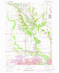
1956 Map of Des Moines NW
USGS Topo · Published 1977About this map
The Des Moines River corridor northwest of the city is dominated by the sprawling Camp Dodge Military Reservation and the massive infrastructure of the Saylorville Dam. This 1956 survey, updated through the mid-1970s, captures the significant transformation of the landscape as Saylorville Lake begins to inundate the valley. Smaller settlements like Herrold and Lovington are visible alongside the emerging suburban growth of Urbandale and Johnston.
Find a feature on this map
58 named features on this map. Tap any name to fly to it.
Don’t see what you’re looking for? This feature index may not catch every label — zoom into the map to look around manually.
Map Details
Editions of this 1956 Des Moines NW Map
5 editions found
Other maps of this area

1905 · Des Moines
USGS Topo · 1:62,500

1907 · Des Moines
USGS Topo · 1:62,500

1908 · Waukee
USGS Topo · 1:62,500

1911 · Madrid
USGS Topo · 1:62,500

1911 · Slater
USGS Topo · 1:62,500

1913 · Slater
USGS Topo · 1:62,500

1914 · Madrid
USGS Topo · 1:62,500

1954 · Des Moines
USGS Topo · 1:250,000

1956 · Des Moines
USGS Topo · 1:250,000

1956 · Des Moines NW
USGS Topo · 1:24,000