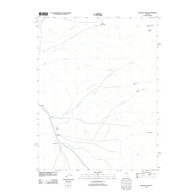
2012 Map of Desatoya Peak
USGS Topo · Published 2012About this map
Desatoya Peak and its sister summit Desatoya North Twin anchor this high-desert landscape in Churchill County, where seasonal drainages and isolated springs define the human and natural geography. The small settlement of Eastgate sits at the western edge of the mountains, positioned near the confluence of Eastgate Wash and Buffalo Creek. This area illustrates a typical Great Basin drainage pattern, where water from peaks like Bald Mountain flows through deeply carved features such as Rock Creek Canyon and Road Canyon. The reliance on local hydrology is evident in the naming of critical water sources like Rock Spring, Big Den Spring, and Park Canyon Spring, which supported travel and ranching in this arid corridor. The map tracks the passage of 722 through the terrain, following the natural grades established by Cripple Creek and Road Canyon Creek through the Desatoya Range.
Find a feature on this map
24 named features on this map. Tap any name to fly to it.
Don’t see what you’re looking for? This feature index may not catch every label — zoom into the map to look around manually.
Map Details
Editions of this 2012 Desatoya Peak Map
This is the sole edition of this map. No revisions or reprints were ever made.
Other maps of this area

1955 · Millett
USGS Topo · 1:250,000

1956 · South Shoshone Peak
USGS Topo · 1:62,500

1959 · Millett
USGS Topo · 1:250,000

1969 · Camp Creek Canyon
USGS Topo · 1:24,000
1969 · Quartzite Mtn NW
USGS Topo · 1:24,000

1969 · Cold Springs
USGS Topo · 1:24,000

1969 · Desatoya Peak
USGS Topo · 1:24,000

1969 · Carroll Summit
USGS Topo · 1:24,000

1969 · Basque Summit
USGS Topo · 1:24,000

1969 · Eastgate
USGS Topo · 1:24,000