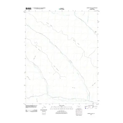
2010 Map of Desert Gulch
USGS Topo · Published 2010About this map
Brush Mountain and the high divide of Skinner Ridge dominate this terrain in Garfield County. The drainage network is clearly defined by several watercourses including Clear Creek, Brush Creek, and Carr Creek, which flow toward the southern valley. Along the southern edge of the sheet, Roan Creek is paralleled by County Hwy-204, the primary thoroughfare through this sparsely settled corridor. The presence of the Cannon Ditch near the southeastern corner suggests a reliance on diverted water for local land management. Distinctive topographical features like Four A Point, Eby Point, and Sheep Gulch provide specific landmarks for those tracing the geographical history of the region. The map reflects a landscape primarily defined by its natural hydrology and the high-elevation ridges that separate these western Colorado watersheds.
Find a feature on this map
18 named features on this map. Tap any name to fly to it.
Don’t see what you’re looking for? This feature index may not catch every label — zoom into the map to look around manually.
Map Details
Editions of this 2010 Desert Gulch Map
This is the sole edition of this map. No revisions or reprints were ever made.
Other maps of this area

1929 · Highmore
USGS Topo · 1:62,500

1929 · Roan Creek
USGS Topo · 1:62,500

1956 · Grand Junction
USGS Topo · 1:250,000

1959 · Grand Junction
USGS Topo · 1:250,000

1960 · Grand Junction
USGS Topo · 1:250,000

1962 · Grand Junction
USGS Topo · 1:250,000

1964 · Grand Junction
USGS Topo · 1:250,000

1964 · Henderson Ridge
USGS Topo · 1:24,000
1964 · Razorback Ridge
USGS Topo · 1:24,000

1965 · Grand Junction
USGS Topo · 1:250,000