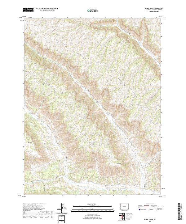
2022 Map of Desert Gulch
USGS Topo · Published 2022About this map
Roan Cr and its associated valley drainage systems define this high-altitude landscape in Garfield County. The terrain is characterized by prominent ridges and points, including Skinner Ridge, Eby Point, and 4A Point, which overlook a network of deep gulches and creek beds. In the northern reaches, Brush Mtn rises above the headwaters of Brush Cr and Cherry Gulch.
Find a feature on this map
22 named features on this map. Tap any name to fly to it.
Don’t see what you’re looking for? This feature index may not catch every label — zoom into the map to look around manually.
Map Details
Editions of this 2022 Desert Gulch Map
This is the sole edition of this map. No revisions or reprints were ever made.
Other maps of this area

1929 · Highmore
USGS Topo · 1:62,500

1929 · Roan Creek
USGS Topo · 1:62,500

1956 · Grand Junction
USGS Topo · 1:250,000

1959 · Grand Junction
USGS Topo · 1:250,000

1960 · Grand Junction
USGS Topo · 1:250,000

1962 · Grand Junction
USGS Topo · 1:250,000

1964 · Grand Junction
USGS Topo · 1:250,000

1964 · Henderson Ridge
USGS Topo · 1:24,000
1964 · Razorback Ridge
USGS Topo · 1:24,000

1965 · Grand Junction
USGS Topo · 1:250,000