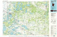
1986 Map of Detroit Lakes
USGS Topo · Published 1986About this map
The White Earth Indian Reservation and Tamarac National Wildlife Refuge dominate the northern landscape of this mid-1980s survey, illustrating a region defined by extensive public lands and an intricate glacial hydrology. The terrain is marked by the Height of Land ridge, a significant geographical divide that separates the western-flowing Buffalo River from the dense lake clusters to the east. Large protected areas such as Smoky Hills State Forest and Maplewood State Park preserve the character of the woods and wetlands.
Find a feature on this map
82 named features on this map. Tap any name to fly to it.
Don’t see what you’re looking for? This feature index may not catch every label — zoom into the map to look around manually.
Map Details
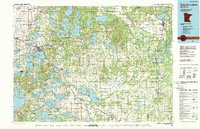
Editions of this 1986 Detroit Lakes Map
2 editions found
Other maps of this area

1912 · Vergas
USGS Topo · 1:62,500

1912 · Battle Lake
USGS Topo · 1:62,500

1913 · Fergus Falls
USGS Topo · 1:62,500

1914 · Battle Lake
USGS Topo · 1:62,500

1914 · Pelican Rapids
USGS Topo · 1:62,500

1915 · Underwood
USGS Topo · 1:62,500

1915 · Perham
USGS Topo · 1:62,500

1915 · Vergas
USGS Topo · 1:62,500

1917 · Pelican Rapids
USGS Topo · 1:62,500

1918 · Flom
USGS Topo · 1:62,500