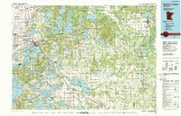
1986 Map of Detroit Lakes
USGS Topo · Published 1989About this map
White Earth Indian Reservation and the Tamarac National Wildlife Refuge dominate the northern landscape of this mid-1980s survey, illustrating a region defined by its dense network of glacial lakes and wetlands. The city of Detroit Lakes serves as the primary hub, where the tracks of the Burlington Northern and Soo Line railroads intersect, highlighting the area's historical reliance on rail transport for both agriculture and tourism. To the south, Maplewood State Park and Dead Lake show the transition into the diverse lake country of Otter Tail County.
Find a feature on this map
154 named features on this map. Tap any name to fly to it.
Don’t see what you’re looking for? This feature index may not catch every label — zoom into the map to look around manually.
Map Details
Editions of this 1986 Detroit Lakes Map
2 editions found
Other maps of this area

1912 · Vergas
USGS Topo · 1:62,500

1912 · Battle Lake
USGS Topo · 1:62,500

1913 · Fergus Falls
USGS Topo · 1:62,500

1914 · Battle Lake
USGS Topo · 1:62,500

1914 · Pelican Rapids
USGS Topo · 1:62,500

1915 · Underwood
USGS Topo · 1:62,500

1915 · Perham
USGS Topo · 1:62,500

1915 · Vergas
USGS Topo · 1:62,500

1917 · Pelican Rapids
USGS Topo · 1:62,500

1918 · Flom
USGS Topo · 1:62,500