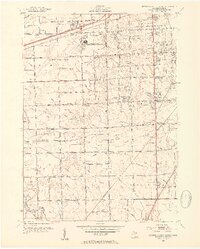
1952 Map of Detroit-Wayne Airport
USGS Topo · Published 1954About this map
The Detroit-Wayne Airport occupies a central position on this 1952 study, reflecting the rapid transformation of the Wayne County landscape as aviation and industry expanded outward from Detroit. Beyond the runways, a dense network of drainage canals, such as the Jacques Drain and Frank and Poet Drain, underscores the engineering efforts required to develop this low-lying terrain. The surrounding townships of Taylor and Brownstown are characterized by a transition from rural agricultural plots to early suburban clusters like Taylor Center and Brighton.
Find a feature on this map
78 named features on this map. Tap any name to fly to it.
Don’t see what you’re looking for? This feature index may not catch every label — zoom into the map to look around manually.
Map Details
Editions of this 1952 Detroit-Wayne Airport Map
2 editions found
Other maps of this area

1905 · Wayne
USGS Topo · 1:62,500

1905 · Detroit
USGS Topo · 1:62,500

1906 · Wyandotte
USGS Topo · 1:62,500

1906 · Romulus
USGS Topo · 1:62,500

1912 · Wyandotte
USGS Topo · 1:62,500

1912 · Wayne
USGS Topo · 1:62,500

1918 · Detroit
USGS Topo · 1:62,500

1924 · Detroit
USGS Topo · 1:62,500

1928 · Romulus
USGS Topo · 1:62,500

1929 · Wyandotte
USGS Topo · 1:62,500