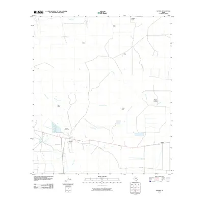
2010 Map of Devers
USGS Topo · Published 2010About this map
The settlement of Devers serves as the hub for this portion of Liberty County, situated where the southern coastal prairie meets an intricate network of slow-moving waterways. The landscape is defined by its agricultural and drainage patterns, with the Rice Belt Rd tracing the region's long-standing connection to local rice farming. To the north and east, the terrain opens into Stockpen Prairie, a name reflecting the area's ranching heritage. Local movement is dictated by the passage across numerous gullies and bayous, including notable landmarks like Hogpen Crossing on Willow Creek. Water management is prominent through features such as the Stephen Meche Dam, which regulates flow near the town. Smaller outposts like Felicia, Taylor Camp, and Keys Camp are scattered across the quadrangle, connected by local routes like Gates Rd and Frost Rd.
Find a feature on this map
22 named features on this map. Tap any name to fly to it.
Don’t see what you’re looking for? This feature index may not catch every label — zoom into the map to look around manually.
Map Details
Editions of this 2010 Devers Map
This is the sole edition of this map. No revisions or reprints were ever made.
Other maps of this area

1943 · Whites Bayou
USGS Topo · 1:24,000

1943 · Liberty
USGS Topo · 1:125,000

1945 · Nolte
USGS Topo · 1:31,680

1950 · Houston
USGS Topo · 1:250,000

1954 · Beaumont
USGS Topo · 1:250,000

1955 · Daisetta
USGS Topo · 1:62,500

1955 · Sour Lake
USGS Topo · 1:62,500

1956 · Houston
USGS Topo · 1:250,000

1957 · Beaumont
USGS Topo · 1:250,000

1961 · Shiloh
USGS Topo · 1:24,000