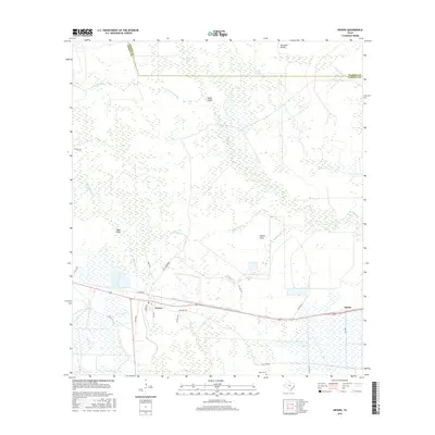
2016 Map of Devers
USGS Topo · Published 2016About this map
Devers sits at the intersection of local history and modern transport in this corner of Liberty County. The landscape is defined by its drainage patterns, where the waters of Batiste Cr, Whites Bayou, and Bull Tongue Cr move through low-lying terrain like Stockpen Prairie and Willow Cove. The map reveals a community structured by long-standing agricultural and transport routes, notably Rice Belt Rd, which speaks to the regional rice-growing heritage. The eastern border is marked by the Hardin Co line near the Six-Ten Slough. Genealogy interests are served by the location of Sahara Cem in the south, while the small settlement of Felicia appears along the eastern rail and highway corridor. The intricate network of private and county roads, such as Co RD 117 and Meche RD, shows how land was subdivided and accessed in the early 21st century.
Find a feature on this map
29 named features on this map. Tap any name to fly to it.
Don’t see what you’re looking for? This feature index may not catch every label — zoom into the map to look around manually.
Map Details
Editions of this 2016 Devers Map
This is the sole edition of this map. No revisions or reprints were ever made.
Other maps of this area

1943 · Whites Bayou
USGS Topo · 1:24,000

1943 · Liberty
USGS Topo · 1:125,000

1945 · Nolte
USGS Topo · 1:31,680

1950 · Houston
USGS Topo · 1:250,000

1954 · Beaumont
USGS Topo · 1:250,000

1955 · Daisetta
USGS Topo · 1:62,500

1955 · Sour Lake
USGS Topo · 1:62,500

1956 · Houston
USGS Topo · 1:250,000

1957 · Beaumont
USGS Topo · 1:250,000

1961 · Shiloh
USGS Topo · 1:24,000